Engineering Geological Mapping
Geotechnical or Engineering Geological Mapping is conducted by a suitably qualified geotechnical engineer/engineering geologist based on a site walkover assessment and review of available information such as geological maps, topographic maps, survey information and historical aerial images.
During the site walkover the geotechnical engineer/engineering geologist records all relevant site features including:
• Site boundaries and dimensions
• Topography, slope and geomorphology
• Hydrogeology and drainage
• Geology (exposure of soil and rock)
• Erosion
• Vegetation
• Hazards
• Existing buildings, roads and utilities
A scale site map and cross section can then be produced based on the findings.
Geotechnical mapping can be used as a standalone investigation for slope stability assessments, preliminary assessments for Development Applications and developing project concept plans or can be used in conjunction with subsurface geotechnical investigations to provide additional information regarding slopes and surface features of the site. If completed at the early stages of a project it can inform the positioning of elements of the development to avoid high risk zones leading to subsequent savings in cost and liabilities.
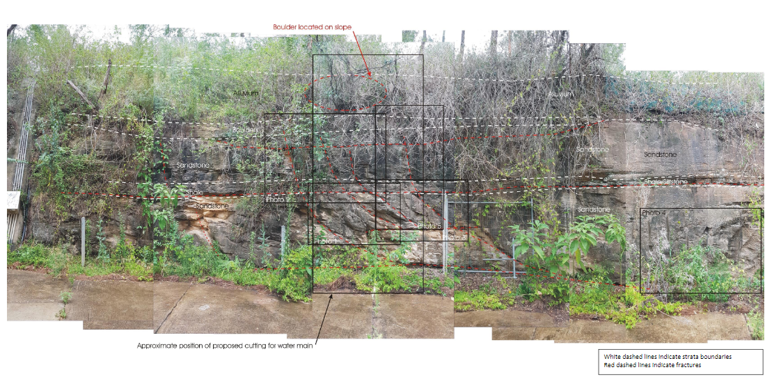
Another aspect of geotechnical mapping that Alliance offers is rock face mapping. Rock face mapping can be undertaken on cuttings where a rock face is exposed, and comprises recording lithology and description, changes in lithology and mapping of defects including defect dip and dip direction with preparation of stereonets. Rock face mapping can be used to provide recommendations for slope stability, slope stabilisation methods, excavatability.


